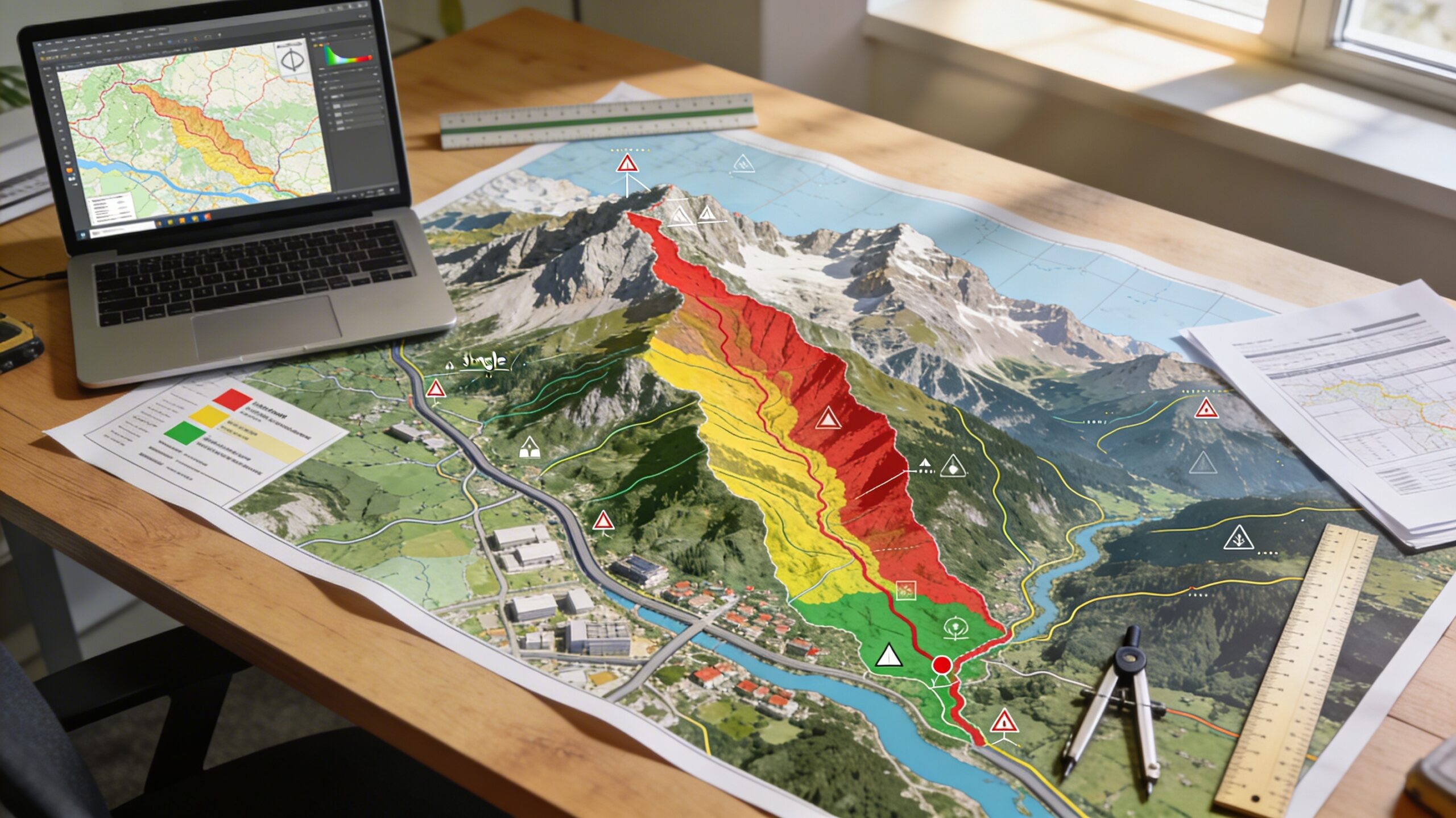
Hazard mapping and risk assessment are central components of landslide management in Europe. Hazard maps identify areas where landslides are more likely to occur, while risk assessment evaluates the potential consequences for people, infrastructure, and economic assets.
These tools help planners, engineers, and authorities make informed decisions about land use, construction, and emergency preparedness. Hazard mapping does not guarantee safety but provides structured information about relative risk levels.
What is landslide hazard mapping?
Landslide hazard mapping is the process of identifying locations where slope failure is more likely to occur based on terrain, geology, hydrology, and historical data.
Hazard maps are widely used in European land-use planning and infrastructure development.
Typical inputs used in hazard mapping include:
- Digital elevation models
- Geological formations
- Historical landslide inventories
- Rainfall and climate data
- Vegetation cover
Hazard maps are usually classified into zones such as low, medium, and high susceptibility regions.
How hazard maps are created
Modern hazard mapping combines field investigation, remote sensing, and numerical modelling.
Data collection
Mapping begins with terrain and geological data acquisition.
- Satellite imagery
- LiDAR terrain scanning
- Historical event records
- Hydrological measurements
Susceptibility modelling
Susceptibility models estimate where landslides are more likely to occur based on terrain characteristics.
Several statistical and machine learning approaches are being tested in European research projects, although traditional geotechnical models remain widely used in operational planning.
Validation and calibration
Models are validated using known landslide events. Calibration ensures that predicted susceptibility patterns match observed historical behaviour.
High-quality inventories of past landslides are essential for reliable mapping.
Risk mapping versus hazard mapping
Hazard and risk mapping are often confused but represent different concepts.
| Concept | Meaning |
|---|---|
| Hazard Mapping | Shows probability of landslide occurrence based on terrain and environmental factors |
| Risk Mapping | Combines hazard probability with exposure and vulnerability of population or infrastructure |
Risk maps are more directly related to policy decisions because they consider potential damage consequences.
Who uses hazard maps in Europe?
Several professional groups rely on hazard mapping results.
- Urban and regional planners
- Civil protection authorities
- Infrastructure operators
- Geotechnical engineers
- Environmental regulators
In many European countries, construction permits in mountainous areas require consultation of official hazard maps.
Regional variation in mapping methods
Mapping standards vary across Europe because geology, climate, and administrative systems differ.
For example, Alpine regions often emphasise rockfall and debris flow modelling, while southern European regions focus more on rainfall-triggered slope failures.
National geological surveys are usually responsible for maintaining official hazard inventories.
Risk assessment in practice
Risk assessment combines scientific modelling with planning policy.
The process usually includes three components:
- Probability of slope failure
- Exposure of population or assets
- Expected damage severity
One common metric used in engineering practice is the factor of safety. If the factor of safety falls below a threshold value, slope instability risk is considered significant.
However, risk assessment models contain uncertainty because natural terrain behaviour is complex and variable.
Role of climate and environmental change
Changing climate conditions influence landslide hazard patterns in several ways.
- Increasing rainfall intensity can trigger more frequent slope failures
- Changes in vegetation cover may alter soil stability
- Temperature variation affects freeze–thaw mechanical processes
Climate influence is usually treated as a modifying factor rather than the sole cause of landslides.
Limitations of hazard mapping
Hazard maps are based on models and available data. They cannot predict individual landslide events with certainty.
Common limitations include:
- Incomplete historical records
- Resolution limits of terrain data
- Local geological variations
- Changes in land use after map creation
Maps should be updated periodically as new data becomes available.
Integration with European planning systems
Many European regions are working to integrate hazard information directly into digital land management platforms.
This supports faster decision-making during development planning and infrastructure design.
However, implementation speed varies between countries due to administrative and technical factors.
Future direction of risk mapping
Research continues into automated terrain analysis, multi-source data fusion, and artificial intelligence-assisted hazard detection.
Despite technological advances, expert geological interpretation remains essential in high-risk areas.
Practical meaning for society
Hazard mapping and risk assessment help reduce casualties and infrastructure damage by guiding development away from unstable terrain and supporting emergency planning.
They are prevention tools rather than prediction guarantees.
Long-term resilience depends on combining mapping, engineering, monitoring, and public preparedness.