Living with Landslide Risk in Europe – Seventh Framework Programme (FP7)
SafeLand was a collaborative European research project funded under the Seventh Framework Programme (FP7) of the European Union.
The project addressed landslide hazard, vulnerability, and risk assessment methodologies across diverse European geological and climatic environments.
Project Objective
The primary objective of SafeLand was to improve scientific understanding and modelling of landslide processes in order to enhance hazard assessment, early warning systems, and quantitative risk analysis across Europe.
The project integrated geomechanics, hydrology, remote sensing, numerical modelling, and socio-economic risk evaluation into a harmonised framework.
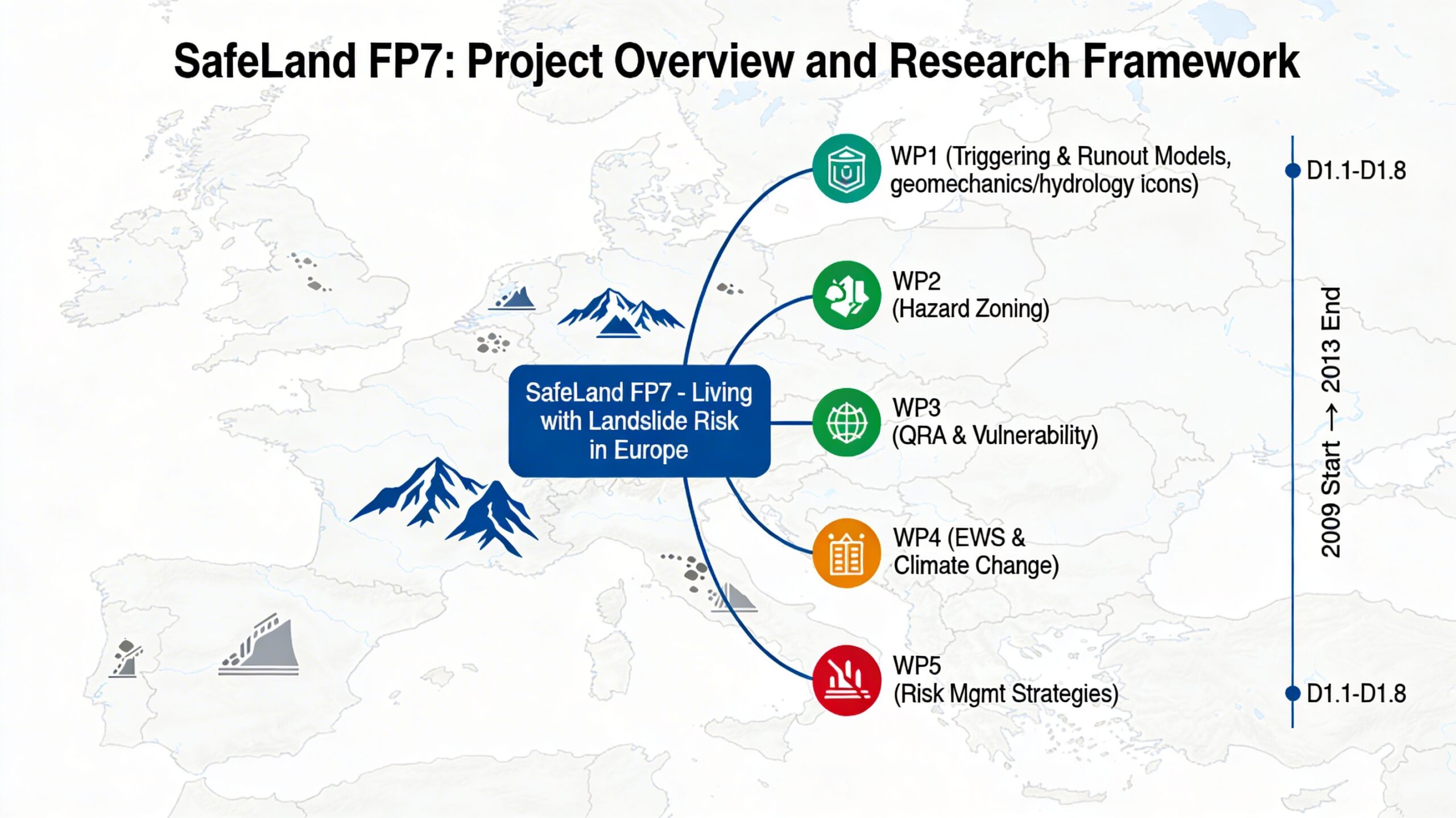
Scientific Structure
SafeLand was organised into multiple work packages addressing different components of landslide risk:
- Hazard mechanisms and triggering processes
- Hydromechanical slope modelling
- Runout dynamics and impact analysis
- Quantitative Risk Assessment (QRA)
- Vulnerability and socio-economic evaluation
These components together form the landslide risk chain:
- Environmental forcing (rainfall, snowmelt, earthquakes)
- Slope response (pore pressure, deformation)
- Failure initiation
- Propagation and runout
- Exposure and vulnerability assessment
- Risk quantification
Work Package 1 – Hazard Mechanisms and Modelling
Work Package 1 (WP1) represents the scientific core of the physical hazard modelling component.
WP1 focuses on understanding landslide triggering mechanisms, numerical simulation tools, and propagation modelling approaches.
- D1.2 – Climate-Driven Slope Deformation
- D1.4 – Numerical Codes for Climate-Induced Landslides
- D1.7 – Landslide Runout Modelling
- D1.8 – Model Selection for QRA
- WP1 Overview Hub
European Context
SafeLand research addressed a wide range of European geological settings:
- Alpine mountain regions
- Volcanic terrains of Southern Europe
- Glacial and moraine deposits
- Flysch and clay-dominated formations
- Coastal and river valley slopes
The methodologies developed were intended to support harmonised risk assessment practices across EU member states.
Methodological Contributions
- Improved modelling of rainfall-induced instability
- Hydromechanical finite element simulations
- Seismic displacement estimation methods
- Runout modelling and deposition forecasting
- Integration into probabilistic risk frameworks
The project emphasised calibration against monitored case studies and benchmark events to ensure model reliability.
Relevance for Risk Management
SafeLand contributes to:
- Hazard zoning and land-use planning
- Early warning system development
- Climate adaptation strategies
- Infrastructure risk assessment
- European disaster risk reduction policies
Archive Purpose
This archive section preserves the scientific and methodological outputs of SafeLand, providing structured access to research deliverables relevant to landslide hazard and risk assessment.
All material is presented for academic, research, and professional reference.